State Government Geospatial Maturity Assessment Form


Understanding the State Government Geospatial Maturity Assessment
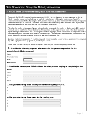
The State Government Geospatial Maturity Assessment is a structured evaluation designed to measure the capabilities of state government agencies in utilizing geospatial data and technologies. This assessment aims to identify strengths and weaknesses in geospatial practices, helping agencies improve their data management and decision-making processes. By focusing on various aspects such as data quality, integration, and technology usage, the assessment provides a comprehensive overview of an agency's geospatial maturity level.
Steps to Complete the State Government Geospatial Maturity Assessment
Completing the State Government Geospatial Maturity Assessment involves several key steps:
- Gather relevant data regarding current geospatial practices and resources within the agency.
- Engage stakeholders to ensure a comprehensive understanding of existing capabilities and challenges.
- Utilize the assessment framework to evaluate the agency's geospatial maturity across defined categories.
- Document findings and identify areas for improvement based on the assessment results.
- Develop an action plan to enhance geospatial capabilities, incorporating feedback from stakeholders.
Key Elements of the State Government Geospatial Maturity Assessment
The assessment comprises several critical elements that contribute to a thorough evaluation:
- Data Quality: Evaluates the accuracy, completeness, and reliability of geospatial data.
- Technology Utilization: Assesses the tools and technologies employed for geospatial analysis and data management.
- Integration: Looks at how well geospatial data is integrated with other data sources and systems.
- Stakeholder Engagement: Measures the involvement of various stakeholders in geospatial initiatives.
- Training and Capacity Building: Evaluates the training programs available for staff to enhance their geospatial skills.
Legal Use of the State Government Geospatial Maturity Assessment
The legal use of the State Government Geospatial Maturity Assessment is governed by various regulations and guidelines that ensure compliance with federal and state laws. Agencies must adhere to data privacy laws, maintain transparency in data usage, and ensure that geospatial data is utilized ethically. Understanding these legal frameworks is essential for agencies to avoid potential liabilities and ensure responsible use of geospatial information.
Examples of Using the State Government Geospatial Maturity Assessment
Agencies can apply the State Government Geospatial Maturity Assessment in various scenarios:
- Evaluating the effectiveness of current geospatial initiatives and identifying gaps in capabilities.
- Informing budget decisions related to geospatial technology investments.
- Enhancing inter-agency collaboration by sharing best practices and lessons learned from the assessment.
- Supporting strategic planning efforts by aligning geospatial capabilities with agency goals.
How to Obtain the State Government Geospatial Maturity Assessment
To obtain the State Government Geospatial Maturity Assessment, agencies typically need to follow a structured process. This may involve:
- Contacting the relevant state department or agency responsible for geospatial initiatives.
- Requesting access to the assessment framework and associated resources.
- Participating in training sessions or workshops that provide guidance on conducting the assessment.
Quick guide on how to complete state government geospatial maturity assessment
Effortlessly prepare [SKS] on any device
Digital document management has gained popularity among businesses and individuals. It serves as an excellent eco-friendly alternative to conventional printed and signed papers, allowing you to acquire the appropriate form and securely store it online. airSlate SignNow equips you with all the tools necessary to create, modify, and eSign your documents swiftly and without delays. Manage [SKS] on any device using airSlate SignNow's Android or iOS applications and enhance any document-based procedure today.
The easiest way to modify and eSign [SKS] with ease
- Find [SKS] and click on Get Form to begin.
- Use the tools we provide to complete your document.
- Highlight important sections of your documents or redact sensitive information with tools that airSlate SignNow offers specifically for that purpose.
- Generate your eSignature using the Sign tool, which takes mere seconds and carries the same legal validity as a traditional wet ink signature.
- Review the information and click on the Done button to save your modifications.
- Choose your preferred method for sharing your form, be it via email, SMS, invitation link, or downloading it to your computer.
Put an end to lost or misfiled documents, tedious form searching, or errors that necessitate printing new copies. airSlate SignNow addresses your document management needs in just a few clicks from any device of your choice. Modify and eSign [SKS] and ensure excellent communication at every step of your form preparation process with airSlate SignNow.
Create this form in 5 minutes or less
Related searches to State Government Geospatial Maturity Assessment
Create this form in 5 minutes!
How to create an eSignature for the state government geospatial maturity assessment
How to create an electronic signature for a PDF online
How to create an electronic signature for a PDF in Google Chrome
How to create an e-signature for signing PDFs in Gmail
How to create an e-signature right from your smartphone
How to create an e-signature for a PDF on iOS
How to create an e-signature for a PDF on Android
People also ask
-
What is the State Government Geospatial Maturity Assessment?
The State Government Geospatial Maturity Assessment is a comprehensive evaluation tool designed to help state governments assess their geospatial capabilities. This assessment identifies strengths and weaknesses in geospatial data management and usage, enabling governments to enhance their decision-making processes and service delivery.
-
How can the State Government Geospatial Maturity Assessment benefit my agency?
By utilizing the State Government Geospatial Maturity Assessment, your agency can gain insights into its current geospatial practices. This assessment helps identify areas for improvement, leading to better resource allocation, enhanced data sharing, and improved public services.
-
What features are included in the State Government Geospatial Maturity Assessment?
The State Government Geospatial Maturity Assessment includes a detailed analysis of your agency's geospatial data infrastructure, workflows, and technology usage. It also provides actionable recommendations and a roadmap for enhancing geospatial capabilities tailored to your agency's specific needs.
-
Is the State Government Geospatial Maturity Assessment customizable?
Yes, the State Government Geospatial Maturity Assessment can be customized to fit the unique requirements of your agency. This ensures that the assessment addresses specific challenges and goals, providing a more relevant and effective evaluation of your geospatial maturity.
-
What is the pricing structure for the State Government Geospatial Maturity Assessment?
The pricing for the State Government Geospatial Maturity Assessment varies based on the size of your agency and the scope of the assessment. We offer competitive pricing options to ensure that all state governments can access this valuable tool for improving their geospatial capabilities.
-
How long does the State Government Geospatial Maturity Assessment take?
The duration of the State Government Geospatial Maturity Assessment depends on the complexity of your agency's operations. Typically, the assessment can be completed within a few weeks, allowing your agency to quickly implement improvements based on the findings.
-
Can the State Government Geospatial Maturity Assessment integrate with existing systems?
Absolutely! The State Government Geospatial Maturity Assessment is designed to work seamlessly with your existing systems and technologies. This integration ensures that the recommendations provided can be easily implemented within your current infrastructure.
Get more for State Government Geospatial Maturity Assessment
- Intent relocation letter child relocation agreement template form
- Intent to purchase agreement template form
- Inter company agreement template form
- Intellectual property transfer agreement template form
- Inter company loan agreement template 787743368 form
- Interagency agreement template form
- Interchange agreement template form
- Intercompany asset transfer agreement template form
Find out other State Government Geospatial Maturity Assessment
- Sign New Hampshire Startup Business Plan Template Free
- Sign New Hampshire Startup Business Plan Template Secure
- Sign New Hampshire Startup Business Plan Template Fast
- Sign South Carolina General Power of Attorney Template Online
- Sign New Hampshire Startup Business Plan Template Simple
- How To Sign New Hampshire Startup Business Plan Template
- Sign New Hampshire Startup Business Plan Template Easy
- Sign New Hampshire Startup Business Plan Template Safe
- Sign South Carolina General Power of Attorney Template Computer
- How Do I Sign New Hampshire Startup Business Plan Template
- Sign South Carolina General Power of Attorney Template Mobile
- How To Sign South Carolina General Power of Attorney Template
- Sign South Carolina General Power of Attorney Template Now
- Help Me With Sign New Hampshire Startup Business Plan Template
- How Do I Sign South Carolina General Power of Attorney Template
- Help Me With Sign South Carolina General Power of Attorney Template
- How Can I Sign South Carolina General Power of Attorney Template
- Sign South Carolina General Power of Attorney Template Later
- Can I Sign South Carolina General Power of Attorney Template
- Sign South Carolina General Power of Attorney Template Myself