Gps Observation Log Sheets Form


What is the Gps Observation Log Sheets Form
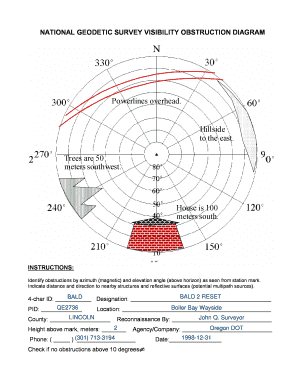
The Gps Observation Log Sheets Form is a specialized document used primarily for recording and tracking GPS observations during various activities, such as field research, surveying, or environmental monitoring. This form helps ensure accurate data collection and provides a structured way to document the specifics of each observation, including time, location, and conditions. It is essential for maintaining reliable records that can be referenced in future analyses or reports.
How to use the Gps Observation Log Sheets Form
Using the Gps Observation Log Sheets Form involves several straightforward steps. First, gather all necessary equipment, including your GPS device and any additional tools needed for your observations. Next, fill out the form with relevant details such as the date, time, and specific location of each observation. It is important to record environmental conditions and any other pertinent notes that may affect the data collected. Once completed, ensure the form is stored securely, whether digitally or in physical form, for future reference.
Steps to complete the Gps Observation Log Sheets Form
Completing the Gps Observation Log Sheets Form requires careful attention to detail. Follow these steps for accurate completion:
- Start with the date and time of your observation.
- Record the GPS coordinates, ensuring accuracy.
- Document the environmental conditions, such as weather or terrain.
- Include any relevant notes, such as observations of wildlife or plant species.
- Review the completed form for any missing information before finalizing.
Legal use of the Gps Observation Log Sheets Form
The legal use of the Gps Observation Log Sheets Form is crucial for ensuring that the collected data is admissible in various contexts, such as research studies or environmental assessments. To be considered legally valid, the form must be completed accurately and truthfully, adhering to any applicable regulations. Additionally, retaining a signed copy may be necessary for compliance with specific legal requirements or organizational policies.
Key elements of the Gps Observation Log Sheets Form
Key elements of the Gps Observation Log Sheets Form include:
- Date and time of observation
- GPS coordinates
- Environmental conditions
- Observer's name and signature
- Any additional notes or comments
These components are essential for maintaining the integrity of the data collected and ensuring that it can be effectively utilized in future analyses.
Examples of using the Gps Observation Log Sheets Form
Examples of using the Gps Observation Log Sheets Form can be found in various fields. For instance, environmental scientists may use the form to track wildlife migration patterns, while land surveyors might document property boundaries. Additionally, researchers conducting studies on climate change may utilize the form to log changes in vegetation over time. Each of these applications highlights the form's versatility and importance in ensuring accurate data collection.
Quick guide on how to complete gps observation log sheets form
Effortlessly prepare Gps Observation Log Sheets Form on any device
Digital document management has gained traction among companies and individuals. It serves as an excellent eco-friendly substitute for traditional printed and signed documents, allowing you to access the necessary form and securely store it online. airSlate SignNow provides you with all the tools necessary to create, edit, and electronically sign your documents swiftly without delays. Manage Gps Observation Log Sheets Form on any device using the airSlate SignNow Android or iOS applications and enhance any document-oriented process today.
The simplest way to modify and electronically sign Gps Observation Log Sheets Form with ease
- Find Gps Observation Log Sheets Form and click on Get Form to begin.
- Utilize the tools we provide to fill out your document.
- Emphasize relevant sections of your documents or obscure sensitive information using tools that airSlate SignNow provides specifically for that purpose.
- Generate your electronic signature using the Sign tool, which takes only seconds and carries the same legal validity as a conventional wet ink signature.
- Review all information carefully and click on the Done button to save your changes.
- Select how you wish to send your form, whether by email, text message (SMS), or invite link, or download it to your computer.
Eliminate worries about lost or misplaced documents, tedious form searches, or errors that require printing new document copies. airSlate SignNow meets all your document management needs with just a few clicks from any device you prefer. Modify and electronically sign Gps Observation Log Sheets Form and ensure excellent communication at every stage of your form preparation process with airSlate SignNow.
Create this form in 5 minutes or less
Create this form in 5 minutes!
How to create an eSignature for the gps observation log sheets form
How to create an electronic signature for a PDF online
How to create an electronic signature for a PDF in Google Chrome
How to create an e-signature for signing PDFs in Gmail
How to create an e-signature right from your smartphone
How to create an e-signature for a PDF on iOS
How to create an e-signature for a PDF on Android
People also ask
-
What is a Gps Observation Log Sheets Form?
A Gps Observation Log Sheets Form is a digital document that helps businesses track GPS observations in a structured manner. It simplifies data management and ensures accuracy in reporting. With airSlate SignNow, you can create and customize this form to meet your specific logging needs.
-
How can I create a Gps Observation Log Sheets Form using airSlate SignNow?
Creating a Gps Observation Log Sheets Form with airSlate SignNow is straightforward. You can use our intuitive drag-and-drop editor to build your form quickly. Additionally, you can easily add fields for GPS data, signatures, and other necessary information.
-
Are there any pricing options for using Gps Observation Log Sheets Form?
Yes, airSlate SignNow offers flexible pricing plans to suit various business needs. Whether you require basic form functionalities or advanced features, you can choose the plan that fits your budget. Our Gps Observation Log Sheets Form capabilities are included in all subscription tiers.
-
What are the key features of the Gps Observation Log Sheets Form?
Key features of the Gps Observation Log Sheets Form include customizable templates, eSignature capabilities, and secure data storage. Additionally, our platform allows real-time collaboration, making it easier for teams to manage GPS logs efficiently. These features help enhance productivity and accuracy in data collection.
-
Can I integrate the Gps Observation Log Sheets Form with other applications?
Absolutely! airSlate SignNow supports integrations with various applications, allowing you to connect your Gps Observation Log Sheets Form with tools you already use. Whether you need to sync data with CRM systems or cloud storage solutions, our platform can streamline your workflows seamlessly.
-
What benefits does the Gps Observation Log Sheets Form provide for businesses?
The Gps Observation Log Sheets Form offers numerous benefits, including increased efficiency, improved accuracy, and enhanced compliance in logging GPS observations. By digitizing your logs, you reduce paperwork and minimize errors, leading to better decision-making. Our solution empowers teams to focus on core activities.
-
Is the Gps Observation Log Sheets Form customizable?
Yes, the Gps Observation Log Sheets Form is fully customizable. You can modify fields, layout, and branding to match your specific requirements. This level of customization ensures that the form aligns with your business processes, making it an ideal solution for varied applications.
Get more for Gps Observation Log Sheets Form
Find out other Gps Observation Log Sheets Form
- eSign Indiana Home Improvement Contract Myself
- eSign North Dakota Architectural Proposal Template Online
- How To eSignature Alabama Mechanic's Lien
- Can I eSign Alabama Car Insurance Quotation Form
- eSign Florida Car Insurance Quotation Form Mobile
- eSign Louisiana Car Insurance Quotation Form Online
- Can I eSign Massachusetts Car Insurance Quotation Form
- eSign Michigan Car Insurance Quotation Form Online
- eSign Michigan Car Insurance Quotation Form Mobile
- eSignature Massachusetts Mechanic's Lien Online
- eSignature Massachusetts Mechanic's Lien Free
- eSign Ohio Car Insurance Quotation Form Mobile
- eSign North Dakota Car Insurance Quotation Form Online
- eSign Pennsylvania Car Insurance Quotation Form Mobile
- eSignature Nevada Mechanic's Lien Myself
- eSign California Life-Insurance Quote Form Online
- How To eSignature Ohio Mechanic's Lien
- eSign Florida Life-Insurance Quote Form Online
- eSign Louisiana Life-Insurance Quote Form Online
- How To eSign Michigan Life-Insurance Quote Form