Gis Form PDF


What is the GIS Form PDF?
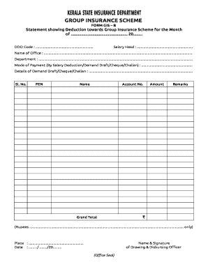
The GIS Form PDF is a standardized document used for various purposes, including applications for permits, registrations, or certifications related to geographic information systems. This form is essential for individuals and businesses needing to submit information related to land use, zoning, or property assessments. By utilizing the GIS Form PDF, users can ensure that their submissions are organized and meet the necessary requirements set forth by local or state authorities.
How to Obtain the GIS Form PDF
Obtaining the GIS Form PDF is a straightforward process. Users can typically download the form directly from official government websites or agencies that manage geographic information systems. It is important to ensure that the downloaded form is the most recent version to comply with current regulations. Additionally, some local offices may provide physical copies of the form upon request.
Steps to Complete the GIS Form PDF
Completing the GIS Form PDF involves several key steps:
- Download the latest version of the GIS Form PDF from an official source.
- Read the instructions carefully to understand the required information.
- Fill in the necessary details, ensuring accuracy and clarity.
- Review the completed form for any errors or omissions.
- Sign the document electronically or manually, depending on submission requirements.
Following these steps will help ensure that the form is completed correctly and submitted on time.
Legal Use of the GIS Form PDF
The GIS Form PDF is legally binding when completed and submitted according to the appropriate guidelines. To ensure its validity, it must be signed by the appropriate parties and submitted to the relevant authorities. Compliance with local and state regulations is crucial, as failure to adhere to these rules can result in delays or rejections of applications. Utilizing a reliable eSignature solution can enhance the legal standing of the completed form.
Key Elements of the GIS Form PDF
Key elements of the GIS Form PDF typically include:
- Applicant Information: Name, address, and contact details of the individual or business submitting the form.
- Property Details: Information about the property in question, including location, size, and current zoning status.
- Purpose of Submission: A clear statement regarding the reason for completing the form, such as applying for a permit or registration.
- Signature Section: A designated area for the applicant's signature, which may require additional verification.
Ensuring that all key elements are accurately filled out is essential for the successful processing of the form.
Form Submission Methods
Submitting the GIS Form PDF can typically be done through various methods, including:
- Online Submission: Many agencies allow users to submit the form electronically through their websites.
- Mail: Users can print the completed form and send it via postal service to the appropriate office.
- In-Person: Some applicants may choose to deliver the form directly to the relevant agency.
Choosing the right submission method depends on the specific requirements of the agency and the applicant's preferences.
Quick guide on how to complete gis form pdf
Complete Gis Form Pdf seamlessly on any device
Web-based document management has become increasingly popular among businesses and individuals. It offers an excellent eco-friendly alternative to traditional printed and signed documents, as you can easily access the right form and securely store it online. airSlate SignNow provides all the tools necessary to create, modify, and eSign your documents swiftly without delays. Manage Gis Form Pdf on any platform with airSlate SignNow Android or iOS applications and streamline any document-related process today.
The easiest way to modify and eSign Gis Form Pdf effortlessly
- Find Gis Form Pdf and then click Get Form to begin.
- Utilize the tools we offer to fill out your document.
- Emphasize signNow sections of your documents or obscure sensitive information with features that airSlate SignNow specifically offers for that purpose.
- Generate your signature with the Sign tool, which takes mere seconds and carries the same legal validity as a conventional wet ink signature.
- Review the details and then click the Done button to save your modifications.
- Choose how you wish to send your form, via email, SMS, invite link, or download it to your computer.
Say goodbye to lost or misplaced documents, monotonous form searches, or mistakes that require printing additional document copies. airSlate SignNow takes care of all your document management needs in just a few clicks from any device you prefer. Edit and eSign Gis Form Pdf and ensure excellent communication at every stage of the form preparation process with airSlate SignNow.
Create this form in 5 minutes or less
Create this form in 5 minutes!
How to create an eSignature for the gis form pdf
How to create an electronic signature for a PDF online
How to create an electronic signature for a PDF in Google Chrome
How to create an e-signature for signing PDFs in Gmail
How to create an e-signature right from your smartphone
How to create an e-signature for a PDF on iOS
How to create an e-signature for a PDF on Android
People also ask
-
What is a GIS form PDF and how can it be used?
A GIS form PDF is a digital document designed for Geographic Information Systems that allows users to input, share, and manage geospatial data. airSlate SignNow simplifies the process of creating and signing GIS form PDFs, streamlining workflows and enhancing collaboration among team members.
-
How does airSlate SignNow ensure the security of GIS form PDFs?
airSlate SignNow employs advanced encryption and security protocols to protect your GIS form PDFs during transmission and storage. Our platform complies with industry standards, ensuring that sensitive geographic information remains confidential and secure throughout the signing process.
-
Can I integrate airSlate SignNow with other software for GIS form PDFs?
Yes, airSlate SignNow integrates seamlessly with a variety of popular software applications and platforms. This allows users to effectively manage GIS form PDFs within their existing systems, increasing productivity and reducing the need for manual data entry.
-
What are the key features of airSlate SignNow for handling GIS form PDFs?
Key features of airSlate SignNow for GIS form PDFs include easy document editing, electronic signatures, template creation, and automated workflows. These features help businesses to quickly process GIS form PDFs, enhance team collaboration, and improve overall efficiency.
-
Is there a mobile app for managing GIS form PDFs with airSlate SignNow?
Yes, airSlate SignNow offers a mobile app that enables users to create, edit, and sign GIS form PDFs on the go. This flexibility ensures that you can manage your documents and workflows from anywhere, making it convenient for fieldwork and remote operations.
-
What pricing plans does airSlate SignNow offer for GIS form PDFs?
airSlate SignNow offers a range of pricing plans tailored to meet different business needs. Each plan includes features for managing GIS form PDFs, with scalable options for individuals, small businesses, and large enterprises to ensure cost-effectiveness.
-
How can airSlate SignNow improve the processing of GIS form PDFs?
By automating the signing and document management process, airSlate SignNow greatly reduces the time and effort spent on GIS form PDFs. This results in increased accuracy, faster turnarounds, and enhanced productivity, allowing your team to focus on critical tasks.
Get more for Gis Form Pdf
- Tfm01 practice test form
- Stcv 204 form
- 14 prescribed under rule 87 notice of period of work for adult workers name of factory form
- Usafa form o 761 2010806 afjrotc nomination for air force academy
- Senior quote template form
- Food stamp change form
- Applications forms permits information
- Lot research request application form
Find out other Gis Form Pdf
- eSign North Dakota Charity Rental Lease Agreement Now
- eSign Arkansas Construction Permission Slip Easy
- eSign Rhode Island Charity Rental Lease Agreement Secure
- eSign California Construction Promissory Note Template Easy
- eSign Colorado Construction LLC Operating Agreement Simple
- Can I eSign Washington Charity LLC Operating Agreement
- eSign Wyoming Charity Living Will Simple
- eSign Florida Construction Memorandum Of Understanding Easy
- eSign Arkansas Doctors LLC Operating Agreement Free
- eSign Hawaii Construction Lease Agreement Mobile
- Help Me With eSign Hawaii Construction LLC Operating Agreement
- eSign Hawaii Construction Work Order Myself
- eSign Delaware Doctors Quitclaim Deed Free
- eSign Colorado Doctors Operating Agreement Computer
- Help Me With eSign Florida Doctors Lease Termination Letter
- eSign Florida Doctors Lease Termination Letter Myself
- eSign Hawaii Doctors Claim Later
- eSign Idaho Construction Arbitration Agreement Easy
- eSign Iowa Construction Quitclaim Deed Now
- How Do I eSign Iowa Construction Quitclaim Deed