Establishing secure connection…Loading editor…Preparing document…

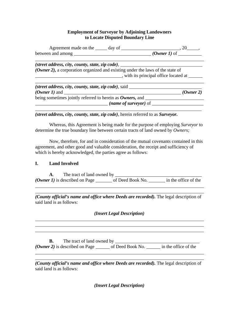
Agreement to Employ Surveyor for Boundary Line Dispute

This template is fully customizable. Edit the text, fill out the fields, and send it for signature. Give it a try!
Agreement to Employ Surveyor for Boundary Line Dispute

What the Agreement to Employ Surveyor for Boundary Line Dispute Is

The Agreement to Employ Surveyor for Boundary Line Dispute is a written contract that engages a licensed surveyor to investigate, determine, and report on the correct boundary line between adjoining properties when ownership or boundary location is contested. It defines the survey scope, deliverables, schedule, payment terms, access authorization, and dispute-resolution procedures. The agreement helps set expectations for both property owners and the surveyor, preserves evidence of consent to the survey, and can be used as supporting documentation in administrative proceedings or litigation involving title or boundary issues.

Why this Agreement Matters for Boundary Disputes

A clear written engagement reduces ambiguity about scope, cost, timing, and legal responsibilities, improving the likelihood of a usable survey and reducing the chance of later claims about scope or authority.

Why this Agreement Matters for Boundary Disputes

Who Typically Uses this Agreement and When

Use the agreement at the outset of a dispute, when title issues are identified during a transaction, or when a municipal or development project requires definitive boundaries.

  • Property owners involved in a contested line who need an impartial professional determination.
  • Title companies securing evidence of boundary location for closing or insurance underwriting.
  • Attorneys or mediators preparing documentation for negotiation, litigation, or quiet-title actions.

Primary Parties and Professional Roles

Property Owner

A residential or commercial property owner who requests the survey and signs the engagement. The owner must provide access, prior deeds or plats if available, and pay agreed fees; accuracy in identifying the property and owner name reduces later enforcement issues.

Licensed Surveyor

A licensed professional surveyor retained under the agreement to perform research, field measurement, legal description drafting, and prepare a signed survey plat. The surveyor’s professional seal and report become evidence used in title, permitting, or court proceedings.

Essential Data and Compliance Elements to Include

Parties: Full legal names of all contracting parties.
Property ID: Address, parcel number, and legal description.
Scope of Work: Specific survey type and tasks.
Deliverables: Plats, reports, and file formats.
Fees: Payment schedule and rates.
Authority: Access permission and utility mark rules.

Risks of Incomplete or Incorrect Agreements

Unenforceable Terms: Ambiguous scope can void obligations.
Boundary Errors: Insufficient data may lead to wrong line.
Delayed Resolution: Missing deadlines prolong disputes.
Extra Costs: Rework and supplemental surveys increase fees.
Evidence Weakness: Unsigned reports may be challenged.
Title Impacts: Incorrect surveys can affect insurance.

Common Preparation and Execution Challenges

  • Incomplete legal descriptions or missing prior plats make research time-consuming and increase the chance of conflicting conclusions.
  • Failure to secure written access or permission to enter adjacent parcels delays fieldwork and can require additional legal steps.
  • Vague language about permitted survey methods or tolerance for discrepancies may cause disputes about whether the survey meets expectations.
  • Not addressing how monuments, fences, and encroachments are to be treated can produce inconsistent results between parties and the surveyor.

Step-by-step: Completing the Agreement

Follow these practical steps to prepare and execute a clear engagement with a surveyor for a boundary dispute.

  • 01
    Identify Property: Enter address, parcel ID, and existing deed references.
  • 02
    Define Scope: Specify type of survey, monuments, and permitted methods.
  • 03
    Set Timeline: Agree milestones for fieldwork, draft, and final plat.
  • 04
    Sign and Authorize: Obtain signatures, access permission, and payment terms.

How the Engagement Typically Progresses

A typical engagement moves from administrative setup to fieldwork, drafting, and final delivery; each stage should be defined in the agreement to avoid misunderstandings.

  • Contracting: Agree scope, fees, and access in writing.
  • Research: Surveyor reviews deeds, plats, and records.
  • Fieldwork: On-site measurement and monumentation.
  • Report: Draft and final survey with seal delivered.

Key Components to Include in a Professional Engagement

A robust agreement anticipates technical, legal, and administrative needs by clearly defining responsibilities, deliverables, and remedies.

Scope

Describe specific survey tasks, whether boundary retracement, location of improvements, monument recovery, or title research, and identify standards to be used.
Deliverables

List required outputs such as stamped plats, field notes, electronic CAD files, and any certified reports with format and number of copies.

Schedule

Set start dates, draft review windows, and final delivery deadlines; include extensions for weather or access issues.

Payment Terms

Specify fees, deposits, milestone payments, and reimbursement for record fees or third-party tests.

Access & Safety

Grant written permission to enter property, note utility-call responsibilities, and define liability for damaged improvements.

Dispute Resolution

Provide procedures for disagreements including mediation, arbitration, expert determination, or court actions and governing law.

Typical Timelines and Expected Turnaround

While schedules vary by project complexity, these milestone targets help set realistic expectations and contractual obligations.

Effective Date:

The date parties sign; obligations and deadlines flow from this date

Survey Start:

Fieldwork commonly begins within 7–21 days after access is authorized

Draft Delivery:

Initial draft plat often delivered within 14–30 days of fieldwork completion

Final Survey:

Final stamped survey typically delivered within 7–21 days after draft approval

Recording/Submission:

If recording is required, allow county recorder processing time; expect 7–60 days

Digital Tools and File Formats for the Agreement

Confirm the vendor supports required integrations and security standards (TLS/AES encryption, audit trail, and, if needed, HIPAA/BAA) before executing electronically.

  • File Formats: PDF and DOCX are standard for signed agreements
  • Integrations: Compatible with Salesforce, NetSuite, Microsoft 365, Google Workspace
  • Signing Methods: Support for email links, SMS codes, and RON where permitted

eSignature Vendor Pricing and Capability Snapshot for Agreement Execution

Compare starter pricing and core capabilities relevant to executing the Agreement to Employ Surveyor for Boundary Line Dispute; signNow is listed first per vendor comparison conventions.

signNow DocuSign Adobe Sign PandaDoc HelloSign
Starting Price $8/user/mo $15/user/mo $14/user/mo $19/user/mo $15/user/mo
Free Trial 7-day free trial Varies by plan Varies by plan Varies by plan Varies by plan
Bulk Send Yes Yes Yes Yes Varies by plan
Audit Trail Yes Yes Yes Yes Yes
HIPAA Compliant Yes Yes Yes No No
Envelope Cap No cap 100 envelopes/user/year Varies by plan Varies by plan Varies by plan

Frequently Asked Questions and Practical Answers

Answers to common questions about execution, notarization, legal effect, and digital signature use for the Agreement to Employ Surveyor for Boundary Line Dispute.


Need help? Contact support

be ready to get more
Join over 28 million airSlate SignNow users