
Fill and Sign the Ireland Health Insurance Form
Practical advice on preparing your ‘Ireland Health Insurance Form’ online
Are you fed up with the burden of handling paperwork? Look no further than airSlate SignNow, the premier electronic signature solution for individuals and businesses. Bid farewell to the lengthy process of printing and scanning documents. With airSlate SignNow, you can effortlessly complete and sign paperwork online. Utilize the powerful tools integrated into this user-friendly and cost-effective platform and transform your method of document management. Whether you need to endorse forms or gather electronic signatures, airSlate SignNow manages it all seamlessly, requiring just a few clicks.
Follow this detailed guide:
- Access your account or initiate a free trial with our service.
- Click +Create to upload a file from your device, cloud, or our template library.
- Open your ‘Ireland Health Insurance Form’ in the editor.
- Click Me (Fill Out Now) to prepare the document on your end.
- Add and designate fillable fields for others (if necessary).
- Proceed with the Send Invite settings to request eSignatures from others.
- Save, print your copy, or convert it into a reusable template.
Don’t fret if you need to collaborate with others on your Ireland Health Insurance Form or send it for notarization—our solution offers everything you require to complete such tasks. Sign up with airSlate SignNow today and elevate your document management to a new level!
FAQs
-
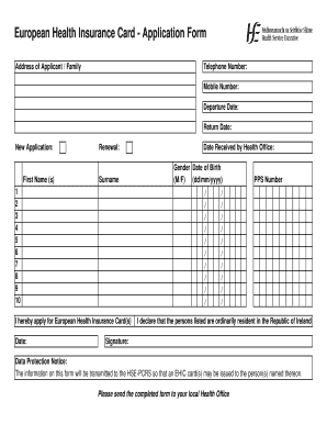
What is the Ireland Health Insurance Form and how can it be used?
The Ireland Health Insurance Form is a specialized document designed for individuals and organizations to manage health insurance needs in Ireland. With airSlate SignNow, you can easily fill out, send, and eSign this form, ensuring that all necessary information is accurately captured and securely stored.
-
How does airSlate SignNow simplify the process of completing the Ireland Health Insurance Form?
airSlate SignNow streamlines the completion of the Ireland Health Insurance Form by providing an intuitive interface for filling out documents. Users can quickly input their details, add signatures, and send the form directly to insurance providers, eliminating the hassle of paper forms and manual submission.
-
What are the pricing options for using airSlate SignNow to manage the Ireland Health Insurance Form?
airSlate SignNow offers flexible pricing plans tailored to different business needs, making it cost-effective for managing the Ireland Health Insurance Form. You can choose from monthly or annual subscriptions, with options that include additional features to enhance your document management capabilities.
-
Can I integrate airSlate SignNow with other applications for managing the Ireland Health Insurance Form?
Yes, airSlate SignNow supports integrations with various applications, allowing you to manage the Ireland Health Insurance Form seamlessly alongside your other business tools. This ensures that you can automate workflows and keep all relevant documents organized in one place.
-
What benefits does airSlate SignNow offer for handling the Ireland Health Insurance Form?
Using airSlate SignNow for the Ireland Health Insurance Form provides numerous benefits, including enhanced security, faster processing times, and reduced administrative overhead. The platform's eSigning capabilities ensure that your documents are legally binding and compliant with Irish regulations.
-
Is it easy to track the status of the Ireland Health Insurance Form once sent through airSlate SignNow?
Absolutely! airSlate SignNow offers real-time tracking for all documents, including the Ireland Health Insurance Form. You can easily see when the form has been sent, viewed, and signed, allowing you to stay informed throughout the process.
-
Are there any mobile options for completing the Ireland Health Insurance Form with airSlate SignNow?
Yes, airSlate SignNow is fully optimized for mobile devices, enabling you to complete the Ireland Health Insurance Form on the go. Whether you're using a smartphone or tablet, you can fill out, send, and sign documents from anywhere, ensuring flexibility and convenience.
Find out other ireland health insurance form
- Close deals faster
- Improve productivity
- Delight customers
- Increase revenue
- Save time & money
- Reduce payment cycles
