Establishing secure connection…Loading editor…Preparing document…
We are not affiliated with any brand or entity on this form.
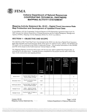
1 Activity I4A Application QFDFIRM Graphic and Database B Floodmaps Fema Form
Handy tips for filling out 1 Activity I4A Application QFDFIRM Graphic And Database B Floodmaps Fema online
Quick steps to complete and e-sign 1 Activity I4A Application QFDFIRM Graphic And Database B Floodmaps Fema online:
- Use Get Form or simply click on the template preview to open it in the editor.
- Start completing the fillable fields and carefully type in required information.
- Use the Cross or Check marks in the top toolbar to select your answers in the list boxes.
- Utilize the Circle icon for other Yes/No questions.
- Look through the document several times and make sure that all fields are completed with the correct information.
- Insert the current Date with the corresponding icon.
- Add a legally-binding e-signature. Go to Sign -> Add New Signature and select the option you prefer: type, draw, or upload an image of your handwritten signature and place it where you need it.
- Finish filling out the form with the Done button.
- Download your copy, save it to the cloud, print it, or share it right from the editor.
- Check the Help section and contact our Support team if you run into any troubles while using the editor.
We understand how straining filling in forms can be. Obtain access to a HIPAA and GDPR compliant service for optimum simpleness. Use airSlate SignNow to e-sign and share 1 Activity I4A Application QFDFIRM Graphic And Database B Floodmaps Fema for e-signing.
Video instructions and help with filling out and completing 1 Activity I4A Application QFDFIRM Graphic And Database B Floodmaps Fema Form

Instructions and help about 1 Activity I4A Application QFDFIRM Graphic And Database B Floodmaps Fema
Create this form in 5 minutes!
How to create an eSignature for the 1 activity i4a application qfdfirm graphic and database b floodmaps fema
How to create an electronic signature for a PDF online
How to create an electronic signature for a PDF in Google Chrome
How to create an e-signature for signing PDFs in Gmail
How to create an e-signature right from your smartphone
How to create an e-signature for a PDF on iOS
How to create an e-signature for a PDF on Android
People also ask
-
How do I see flood zones on Google maps?
Read the map symbols that overlay the place of interest. flood hazard (all the A (i.e., A, AE, etc.) and V (V and VE) zones) are shown in blue. Floodways are shown by red hatching over the areas of high hazard. -
What is the flood risk dataset?
The dataset shows the chance of flooding from rivers and/or the sea, based on cells of 50m. Each cell is allocated one of four flood risk categories, taking into account flood defences and their condition. -
What does flood risk factor mean?
A property's Flood Factor is an indicator of its comprehensive, thirty-year risk of flooding from rainfall, overflowing rivers and streams, high tides, and storm surges, ranging from 1–10. Properties with higher Flood Factors are either more likely to flood, more likely to experience high floods or both. -
What is the FEMA flood risk dataset?
The Flood Risk Assessment dataset provides potential flood damage estimates based on an analysis of flood depths within the built environment. -
What is the difference between FEMA and NFIP?
The National Flood Insurance Program (NFIP) is managed by the FEMA and is delivered to the public by a network of more than 50 insurance companies and the NFIP Direct. -
How do you quantify flood risk?
The flood risk score is generated using inundation depth, flood zone, average mitigation costs, annual damages regarding probability-based flood scenarios for a property and a watershed-level. The risk score can be an input for mitigation decisions (i.e., buyout, dry floodproofing, sandbagging). -
How do I download FEMA data from GIS?
You can also use the address search on the FEMA Flood Map Service Center (MSC) to view the NFHL data or download a FIRMette. Using the “Search All Products” on the MSC, you can download the NFHL data for a County or State in a GIS file format.
Get more for 1 Activity I4A Application QFDFIRM Graphic And Database B Floodmaps Fema
- Cs 95 affidavit for termination of child support courts mo form
- Statement of existing lease agreement form
- Right to work checklist form
- Miami beach construction cost affidavit form
- Community service time log adult pdf hamiltoncounty in form
- Product approval sheet form
- Food defense self assessment checklist form
- Certified court order to change birth record to forms in
Find out other 1 Activity I4A Application QFDFIRM Graphic And Database B Floodmaps Fema
- How To Integrate Sign in Banking
- How Do I Integrate Sign in Banking
- Help Me With Integrate Sign in Banking
- How Can I Integrate Sign in Banking
- Can I Integrate Sign in Banking
- How To Use Sign in Banking
- How Do I Use Sign in Banking
- Help Me With Use Sign in Banking
- How Can I Use Sign in Banking
- Can I Use Sign in Banking
- How To Install Sign in Banking
- How Do I Install Sign in Banking
- Help Me With Install Sign in Banking
- How Can I Install Sign in Banking
- Can I Install Sign in Banking
- How To Add Sign in Banking
- How Do I Add Sign in Banking
- Help Me With Add Sign in Banking
- How Can I Add Sign in Banking
- Can I Add Sign in Banking
If you believe that this page should be taken down, please follow our DMCA take down process here.